| Plattform Platform |
Reise-Nr. Cruise-No. |
Zeitraum Period |
Projekt Project |
Arbeitsgebiet Working area |
|---|---|---|---|---|
| Poseidon | 298-1 | 01.05.2003 - 11.05.2003 | Mediterranean Region Adriatic Sea |
| Fahrtleiter Chief Scientist | Institut Institute | Auslaufhafen Port of departure | Einlaufhafen Port of return | Stationskarte Station map | Schiffsroute Trackchart |
|---|---|---|---|---|---|
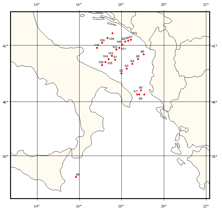
| Klein Brigitte | Institut fur Umweltphysik, Abt. Ozeanographie Universitat Bremen | Faro | Brindisi | Karte Map |
Ziel der Reise / Objectives of Cruise:
Investigation of deep water formation in the Adriatic Standard hydrographic measurements performed with a Sea-CTD characterize water mass structure within the region, while lADCP measurements highlight the flow field. Samples of transient tracers collected during the cruise will give indications about the strength of water mass ventilation and time scales. Data from the recovered mooring in the Adriatic will provide information about the deep water formation activity during the previous winter
Messungen / Measurements
| Institut Institute |
Wissenschaftler Scientist |
Anzahl Number |
Einheit Unit |
Typ der Messungen Type of measurements |
Kommentar Comments |
Daten im DOD Data in DOD |
|---|---|---|---|---|---|---|
| IUPHB | Klein Brigitte | 23 | stations | D71 Current profiler (e.g. ADCP) |
lADCP Profiles | no |
| IUPHB | Klein Brigitte | 25 | stations | H00 Stations |
- | no |
| IUPHB | Klein Brigitte | 23 | stations | H09 Water bottle stations |
Water sampling | no |
| IUPHB | Klein Brigitte | 24 | stations | H10 CTD-Stations |
Seabird CTD | no |
| IUPHB | Klein Brigitte | 23 | stations | H73 Geochemical tracers (e.g. freons) |
Water sampling | no |
Verankerungen / Moorings
| Institut Institute |
Wissenschaftler Scientist |
Typ der Messungen Type of measurements |
Kommentar Comments |
geogr.Breite Latitude |
geogr.Länge Longitude |
Daten im DOD Data in DOD |
|---|---|---|---|---|---|---|
| IUPHB | Klein Brigitte | D01 | The recovered mooring consisted of 1 ADCP, 1 Aanderaa current meter and 5 microcats | 41° 29.7' N | 17° 42.1' E | no |